The Earth’s orbit is full of photographers. Over the last 67 years, more than 15,946 objects have been launched into space, 9,900 of which remain active satellites; according to data from the United Nations Office for Outer Space Affairs. Many of these circling objects have cameras. These are constantly taking pictures of our planet to reveal information about different regions’ weather, climate and, more recently, economic activity.
“NASA has more than two dozen satellites and instruments in orbit that, together, provide layers of complementary information on Earth’s oceans, land, ice and atmosphere,” a NASA spokesperson told Finance Middle East. “Data from these observations are publicly available, ensuring open access for the benefit of all.”
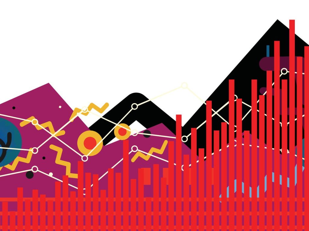
Satellite images have, for years, been capturing data on business activities. From the intensity of a city’s night lights to the amount of rainfall on a country’s crops and including the number of cars in a mall’s parking lot; the view of a territory from above can speak volumes of its economy. With the right data analysis tools, these pictures can prove vital to researchers, civil servants, business leaders and stock traders, opening a door into the Earth’s past and, sometimes, its future.
Satellite vs statistical data
Innovation is often driven by need. In 2020, when the World Bank prepared to publish its regularly scheduled economic monitoring reports, it came across a significant challenge. Many offices’ official statistics on economic activity were delayed, as staff in research and government offices had been unable to go to the office. The solution was found in satellites.
“The brighter the luminosity in a region at night, the higher this region’s economic activity activity and wealth”
Dr Patrick Lehnert

That year, Roberts et al. (2020) used satellite data to track the impact of the COVID-19 crisis in 47 cities of the MENA region, including Algiers, Oran and Constantine. Other researchers have used satellite data to study the impact of demonetisation in India and the tariff war between China and the US. The World Bank researchers followed a similar approach. With the appropriate analytics and robustness tests, satellite imagery accessible on the Earth Observation Group and NASA website, among other free sources, proved an exceptional proxy of economic activity worldwide.
“Once the methodology and quality of the proxy were established, the additional cost to using the data for regular economic monitoring is small,” explained Dr Eric Le Borgne, Manager at the Economic Policy Practice for the Middle East and North Africa at the World Bank. “In our regular economic monitoring reports, the higher frequency, timeliness and granularity enabled us to be one to two quarters ahead of national accounts and provide a sense of spatial dynamics, providing recent analysis that was otherwise unavailable.”
Satellite data—from night lights to agricultural sensors—showcases characteristics different from traditional statistical data. For instance, it is much more frequent and granular. Moreover, it is comparable across countries. Fundamentally, it is accessible.
“Reliable, timely and comprehensive data are essential for economic monitoring, yet such data is often lacking,” Le Borgne noted. There are areas that the Statistics Bureau of the Syrian government does not have access to, and, as illustrated in The Narrow Corridor by Daron Acemoglu and James Robinson, Lebanon has not conducted a population census since 1932. As such, he added, “the World Bank uses alternative data for economic monitoring in many places in MENA, such as Algeria, Libya, Yemen, Syria and West Bank and Gaza.”
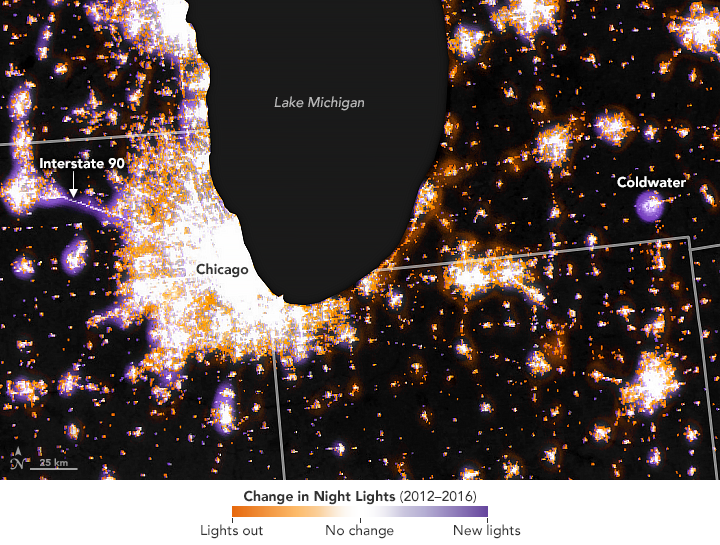
Night lights: a visual GDP
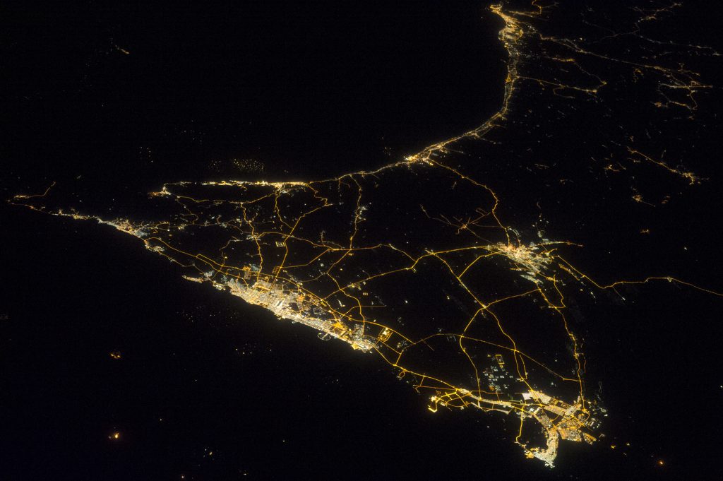
Have you ever seen a bird’s eye picture of a city’s night lights? These images, taken from planes or satellites, are breathtaking. They also hide vast amounts of valuable information.


“The idea is as simple as it is effective,” said Dr Patrick Lehnert, Assistant Professor at the University of Zurich. “The brighter the luminosity in a region at night, the higher this region’s economic activity and wealth.” Of course, nothing related to economic analysis is really as simple, but the main concept remains the same. According to the estimates made by researchers Robert C. M. Beyer, Yingyao Hu and Jiaxiong Yao, in emerging markets and developing economies, a 1% change in quarterly GDP can be associated with a 1.55% change in nighttime light intensity. While the elasticity varies depending on a country’s income status and economic structure, the researchers stressed that deviations from this estimate are small. As such, this elasticity can translate changes in NTL into changes in economic activity. For example, a 10% decline in a nation’s NTL intensity would suggest an economic impact of 6.5% of its GDP.
“The new data are still underused,” the researchers wrote in a blog post. “They can shed even more light on the impact of economic events. Our elasticity will be helpful to approximate their impact on GDP from observed changes in nighttime lights.”

“The World Bank uses alternative data for economic monitoring in many places in MENA, such as Algeria, Libya, Yemen, Syria, and West Bank and Gaza”
Dr Eric Le Borgne
The World Bank applied these calculations to measure Algeria’s economy. Researchers isolated NTL data from gas flaring sites, gas-producing regions and hydrocarbon processing sites were isolated to proxy crude oil and natural gas production and processing. In a simple econometric model, monthly “flaring lights” explained 94% of monthly crude oil production levels, while “non-flaring lights” in gas-producing wilayas explained 69% of monthly natural gas production levels. “The correlation between hydrocarbon GDP and NTL originating from oil and gas production and processing sites is remarkable,” Le Borgne wrote.
The drivers of the non-oil economy also emit light. To model real nonhydrocarbon GDP, the World Bank measured the non-flaring lights in Algeria’s four largest regions (North-West, North-Center, North-East, and Eastern Highlands), representing approximately 80% of the country’s population. In a univariate regression, “NTL explained 87% of the level of real nonhydrocarbon GDP, which increased to 93% when accounting for the trend and seasonality in the data”. Thus, Algeria’s NTL data alone allowed the World Bank to build a robust proxy for the non-hydrocarbon economy and track regional economic dynamics.
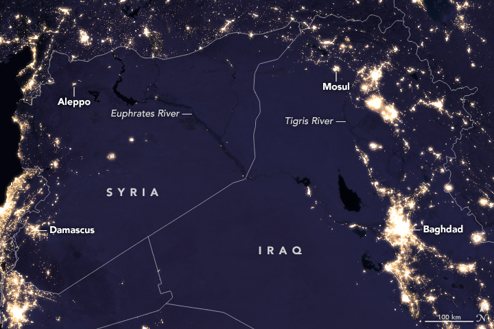
The applications of NTL data analysis extend far beyond GDP calculations. Le Borgne noted that NTL analysis was also conducted to estimate the losses of economic activities in Syria after the 2023 Türkiye–Syria earthquakes and is used today for the World Bank’s regular economic updates on the Palestinian economy.

The value of daytime data
Satellites also collect valuable data during the daytime. In the Middle East, daytime images provided real-time insights into the Red Sea crisis, proved that car imports were almost entirely responsible for the 2023 surge in imports in Algeria and helped measure vegetation indices to track cereal yields in Syria. Over in Europe, Lehnert led a team of scientists that demonstrated that daytime satellite imagery more precisely predicted economic activity at smaller regional levels and over long time horizons than NTL data. Their model was built to measure the impact of higher education institutions on innovation output in East and Western Germany horizons, but its applications extend far beyond.
“When we needed historical economic data at a highly localised level for German regions, a large share of which was behind the Iron Curtain, neither night light data nor available direct measures of GDP met the requirements of reliability and high regional disaggregation,” Lehnert explained, recalling the reasons that led the team to turn to satellites. To obtain the data required for their studies, the research team used machine learning to map different types of land cover and then linked regional land-cover patterns to economic activity, with great success.
“Daytime data are more fine-grained and thus offer more precise information at disaggregated regional levels,” he said. “In addition, they are available over a longer time series.”


Lehnert has continued to work on related projects and expressed excitement regarding the potential applications of the technology, particularly as new technologies emerge.
“The current technological advancements will facilitate the development of even more accurate proxies: modern satellites capture very detailed and very frequent observations of the Earth, thus offering the potential to discern very detailed economic aspects such as building structures or infrastructural developments,” the researcher noted. “Moreover, advances in computation speed enable the application of increasingly sophisticated AI procedures to larger amounts of data. Therefore, further developing the methodologies for leveraging satellite data to obtain economic information is a promising research field that is worth investing in.”
Space to invest
Can this data make money? Well, yes. Increasingly, public and private organisations have begun to leverage satellite data to inform their business and investment decisions.
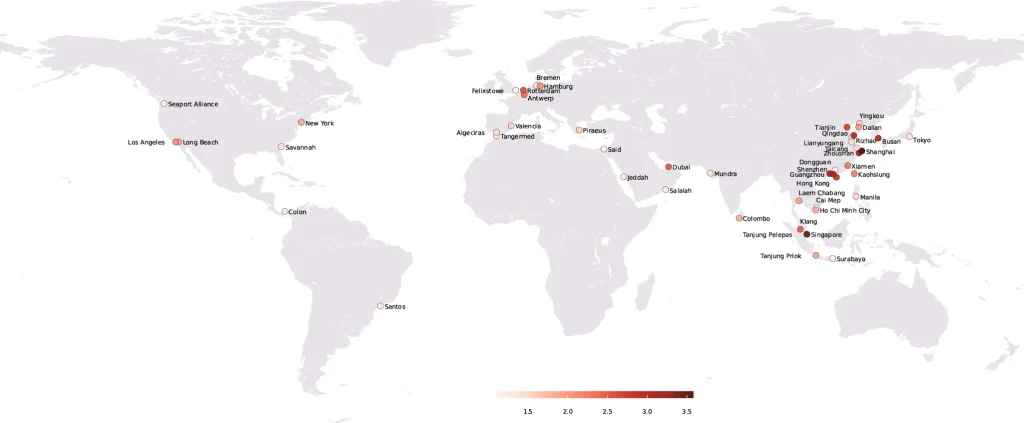
Notably, satellite images of container ports can be used to predict global stock markets, as shown by a study from researchers at the Tongji and Nanjing universities. As 90% of non-bulk dry cargo is shipped by containers, the scientists theorised that an increase in the number of containers stacked in the port would imply decreased demand for shipping service and, thus, lower economic activity. Stock prices would be expected to fall accordingly. To test their hypothesis, the team extracted real-time information from European Space Agency’s Sentinel-2 images of the top 48 container ports and analysed them using a deep learning model.
The results were a roaring success. The researchers were able to predict daily stock index returns in 27 out of 33 countries between 2019 and 2021, suggesting that an investor making use of satellite imagery of seaports would, on average, receive annual returns of 16% and a Sharpe ratio of 1.19. “We believe that, with the development of big data technology, satellite images provide an important information source to help improve investment decisions,” they wrote in an article published in Humanities and Social Sciences Communications.
In the past few years, investors have turned to satellite technology to obtain information on mines, ports, plantations or farmlands they plan to invest in. Companies such as Orbital Insight, Planet Labs, Spire Global and Space Know use private satellites to track industrial facilities, real estate properties, foot traffic activity, oil refineries, petrochemical plants or auto manufacturing centres and generate information about commercial properties. This data can, for instance, anticipate a retailer’s sales performance based on satellite images of parking lots, and advise a client on whether it would be a good investment. In 2016, 70 of the 74 clients of Orbital Insight were hedge funds.
“We are really seeing the increased attention of the non-space sector into what space can bring them in terms of business opportunities and insights. I see it a lot in insurance and finance,” said Mathieu Luinaud, Manager at PwC’s Space Practice and Senior Lecturer in Economics at Sciences Po in Paris. “With a satellite, you can capture a broad perimeter in one single image. And then, there is the option to do data fusion, which combines satellite-enabled data with other types of data—economic data, financial data, etc. That is what unlocks the potential of these space applications.”

“There is a strong case for space data for the financial world in the Middle East”
Dr Mathieu Luinaud
During a conversation with Luinaud, he also cites how insurers have begun to rely on satellite data to help with claim assessments or speed up approvals during natural catastrophes. AXA, for example, has built an entire branch based on space data. The insurer sells contracts that can be triggered automatically if you identify a change in meteorological conditions, as that will affect, for instance, a crop’s production output. “In finance, there is a growing interest from banks and investment funds,” he noted. “The idea being that satellite imagery can help you monitor—with the caveat being the cost of acquiring the data—the assets that you want to purchase, especially if they are in locations you’re not familiar with.”
Counting on the climate
The world of finance is increasingly climate-conscious—and so is its data. A growing area of interest when it comes to business planning is environmental monitoring.
As Luinaud noted, “The boom of sustainable finance is facilitated by employing satellite imagery and satellite data”. This is particularly true of efforts to monitor a facility’s methane leaks or carbon emissions, as this can have a direct impact on the capacity to secure a sustainable bond, as well as ESG performance ratings which, in turn, can have direct financial consequences.
The use of satellite monitoring in a sustainability context goes far beyond real-time tracking. With the right data, analysts can also use these images and readings to predict the future.

Last year, the International Monetary Fund (IMF) unveiled the PortWatch platform. Developed alongside the World Bank, Oxford University, the United Nations and the World Trade Organization, the platform harnesses the power of satellite imagery and satellite-enabled Automatic Identification Systems (AIS), alongside economic datasets and predictive models, to anticipate the impact of climate events on ports and maritime trading routes. This will not only help policymakers, trading companies, investors and the wider public prepare for the physical and economic impact of natural disasters and other climate-related disruptions. Its disaster alert system already provides weekly email alerts on trade disruptions in affected countries.
Fundamentally, environmental monitoring is a key part of economic tracking, as agriculture is a vital sector in many countries’ GDP. For instance, the World Bank used remote sensing indices for vegetation to track cereal yields in Syria, after controlling for the temperature and rainfall factors, which are also available remotely. Additionally, “remote sensing indices for vegetation were used to understand spatial dynamics in crop production in Algeria, caught in between acute water stress in the Western regions and recovery in rainfall in the East” Le Borgne stressed. After all, food was always the first commodity.
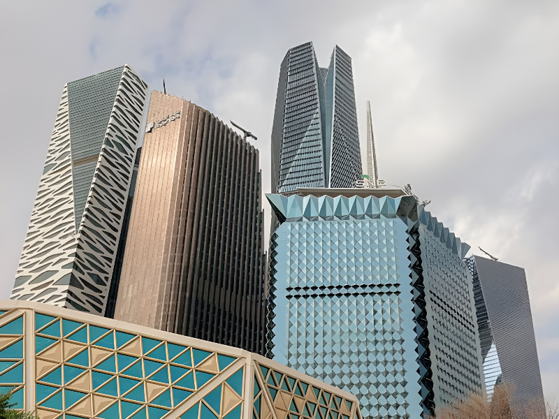
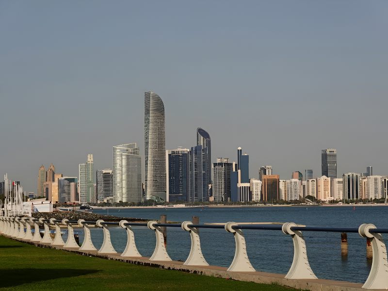
The business of space
The Middle East has indeed showcased a booming space economy, which has tripled over the past decade to an estimated value of $25 billion in 2023 and is predicted to reach $75 billion by 2032, thanks to the sustained growth of government investment and the dynamics of downstream space applications and services, according to data released by the Middle East Space Conference.
Luinaud also sees great potential for the growth of the sector in the Middle East, which has showcased an interest in developing innovative spatial solutions. “The region has, not only a lot of investment power but also the will to invest in the space sector,” he said. “I think there is a strong case for the use of space data for the financial world in the Middle East.”
One of the companies that is taking advantage of the interest in space data is the UAE’s Bayanat. Born out of the commercialisation of the country’s military survey department, the company uses high-resolution satellite imagery from their own constellations, aerial surveys (including those conducted by drones) and ground-based sensors, to gather precise geospatial data for the benefit of sectors such as government, energy, agriculture and defence. Over the years, Bayanat has developed a unique constellation of Low Earth Orbit (LEO) Synthetic Aperture Radar satellites that can capture information independent of weather and time and uses advanced software such as the next-generation AI-powered gIQ platform to process and interpret vast amounts of data.
“Through gIQ we can anticipate trends and scenarios with predictive insights, helping to inform decision-making on the highest level—be it across government or private organisations,” Hasan Al Hosani, Managing Director of Bayanat, told Finance Middle East. “Bayanat’s services offer access to accurate and timely geospatial data which supports strategic decision-making in areas such as site selection, infrastructure planning and resource management to only name a few. Leaders can leverage Bayanat’s advanced geospatial technologies to gain a competitive edge in market positioning and innovation.”
“Marrying space and AI will supercharge many technologies and create efficiencies and productivity levels that we have not seen before”
Hasan Al Hosani

Bayanat’s tools have helped a myriad of decision-makers. Its solutions allow municipalities to measure city movements and traffic patterns to optimise urban planning. Moreover, they have helped authorities manage disruptive natural events such as the Türkiye–Syria earthquakes or the 2024 UAE floods. The company is also contributing to the development of several smart mobility pilots including TXAI, an autonomous taxi service on Abu Dhabi’s YAS Island, and facilitating crop management and yield optimisation through satellite-based monitoring and precision agriculture techniques, among many other projects.
Bayanat is currently in the midst of a merger with Yahsat, which will combine the two companies’ geospatial and satellite communications capabilities to create Space42. The business is expected to capture regional and international opportunities in geospatial and mobility solutions, satellite communications, sustainability initiatives and AI. The Q1 2024 financial results of Bayanat and Yahsat show a combined revenue of Dh2.9 billion and a net income of Dh109 million, which Space42 will be able to build on.
“Space42 is one of the first to act on the opportunity to unlock the full potential of space and ground systems operations through AI-enabled solutions,” Al Hosani added. “The newly formed entity is expected to become one of the most valuable publicly listed space tech companies globally, with significant potential for further growth and synergies.”
The future of the space economy
It is a truth—not universally acknowledged—that a satellite is always watching. To date, the data provided by these circling objects has significantly driven the advancement of humanity’s knowledge. Yet, we have only scratched the surface of the value satellites can provide.
In the years to come, big data is set to become more mainstream for economic monitoring. Three key reasons driving this momentum are the fact that more big datasets are becoming available to researchers, the lowering cost of processing these data tumbles, and the increased value of the insights that these types of data can provide compared to traditional datasets. Add to this the advent of AI, and everything becomes possible.
“Marrying space and AI will supercharge many technologies and create efficiencies and productivity levels that we have not seen before,” Al Hosani said. “We see huge potential in democratising access to space”. Le Borgne agreed.

“We see huge potential in democratising access to space”
Hasan Al Hosani
Nonetheless, more education and better cross-sector communication are required to turbocharge the industry, according to Lehnert and Luinaud. “There are a lot of bridges to be built between the space sector—the people who build these satellites and data sets—and other industries, to make sure that they design the right solutions for the industry to be willing to buy such insights,” Luinaud said. “The other challenge is to have more visibility and clarity on what it is going to cost you as a customer.”
The Middle East, and the world at large, have much to win from the use of satellite data. These images can reveal things we don’t know yet about our past, present and future. In order to understand our surroundings, one only has to look up.